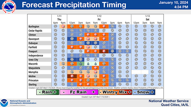
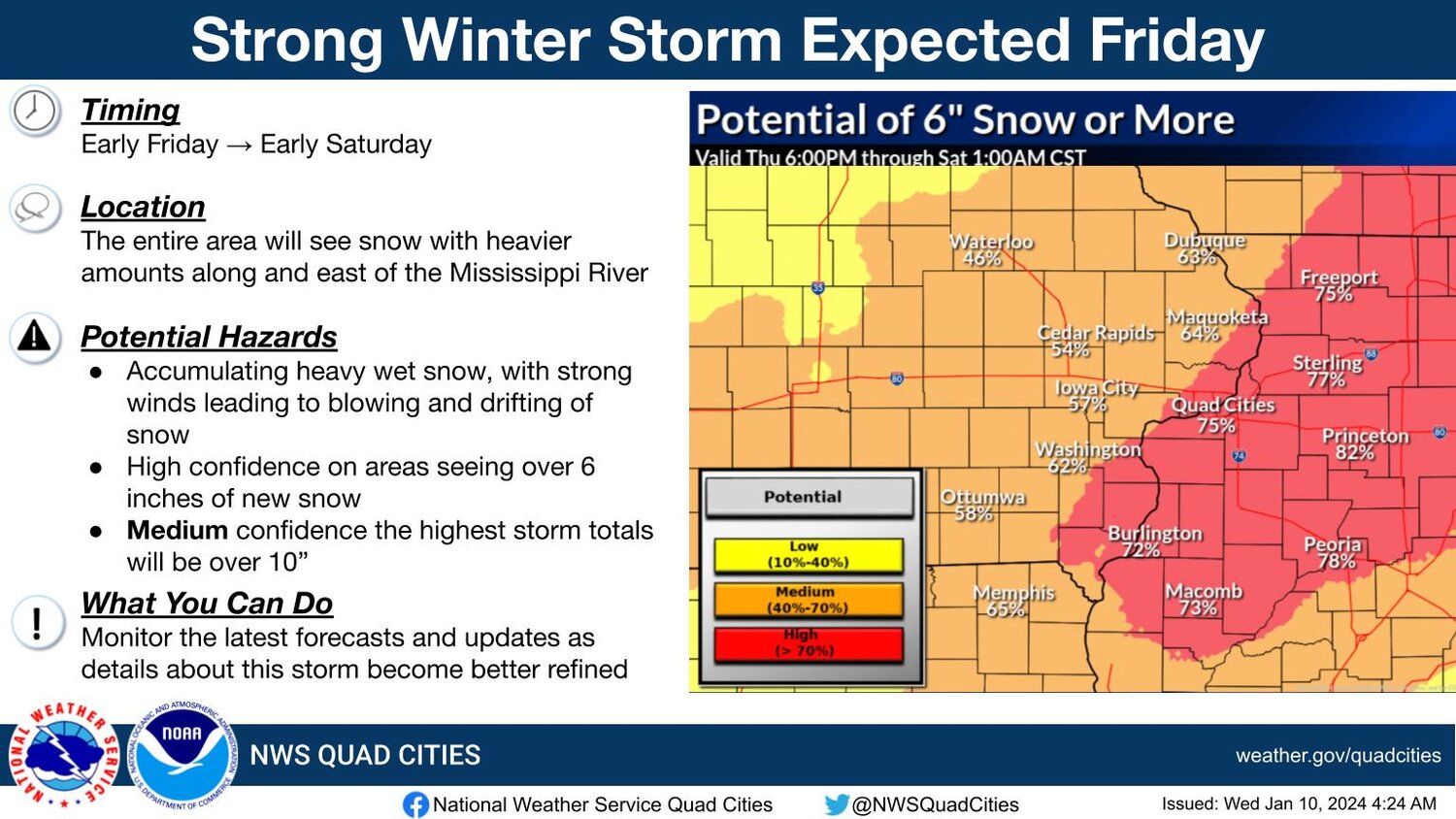
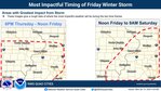
Snow reaching Eastern Iowa by 6 p.m. Thursday is expected to blanket the region again with a high probability of another six to 10 inches, according to today's National Weather Service report from Davenport.
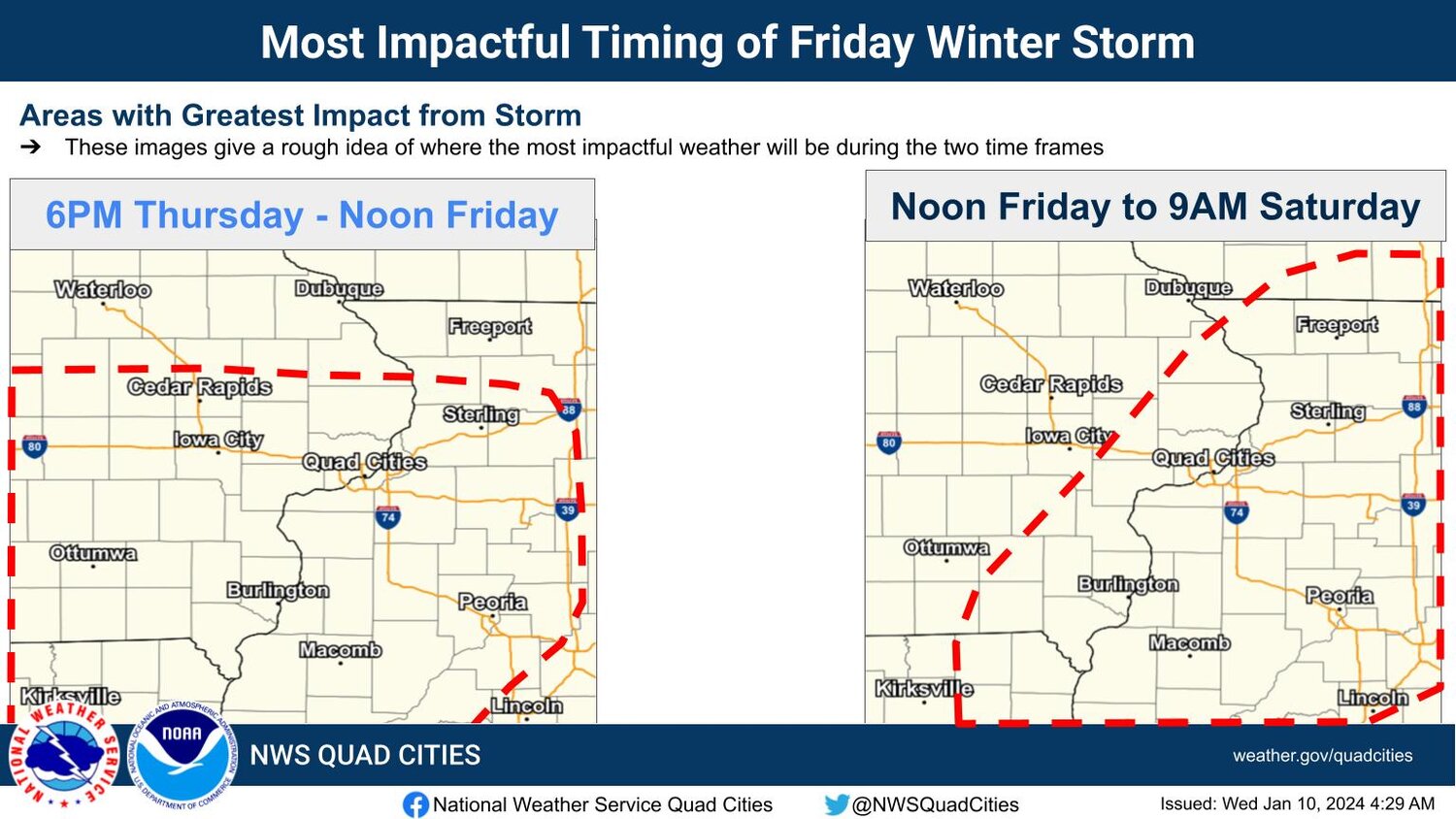
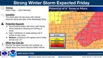
Another long duration strong winter storm will affect the area Thursday overnight into Saturday morning, bringing accumulating snow and strong winds that will result in blowing and drifting of snow.
There are high probabilities that areas will see over 6 inches of snow again. Highest estimates are for Scott County and western Illinois.